Grand Canyon Hiking Trail Guide

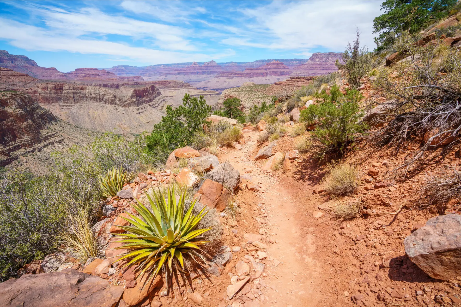
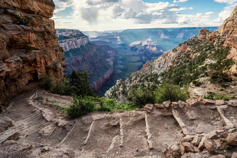
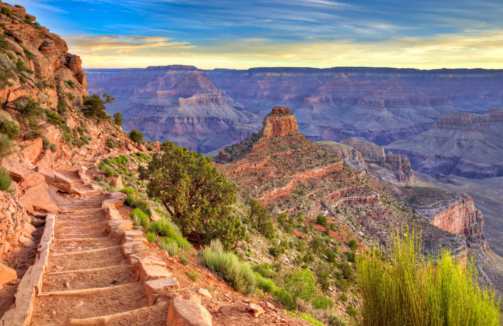
Welcome to Stoney’s Adventures’ Hiking & Trail Guides! Whether you’re a seasoned hiker or just starting out, this section is your go-to resource for exploring the magnificent trails of the Grand Canyon. Let’s dive into some of the most popular trails, essential safety tips, and unique insights to make your Grand Canyon hiking experience unforgettable.

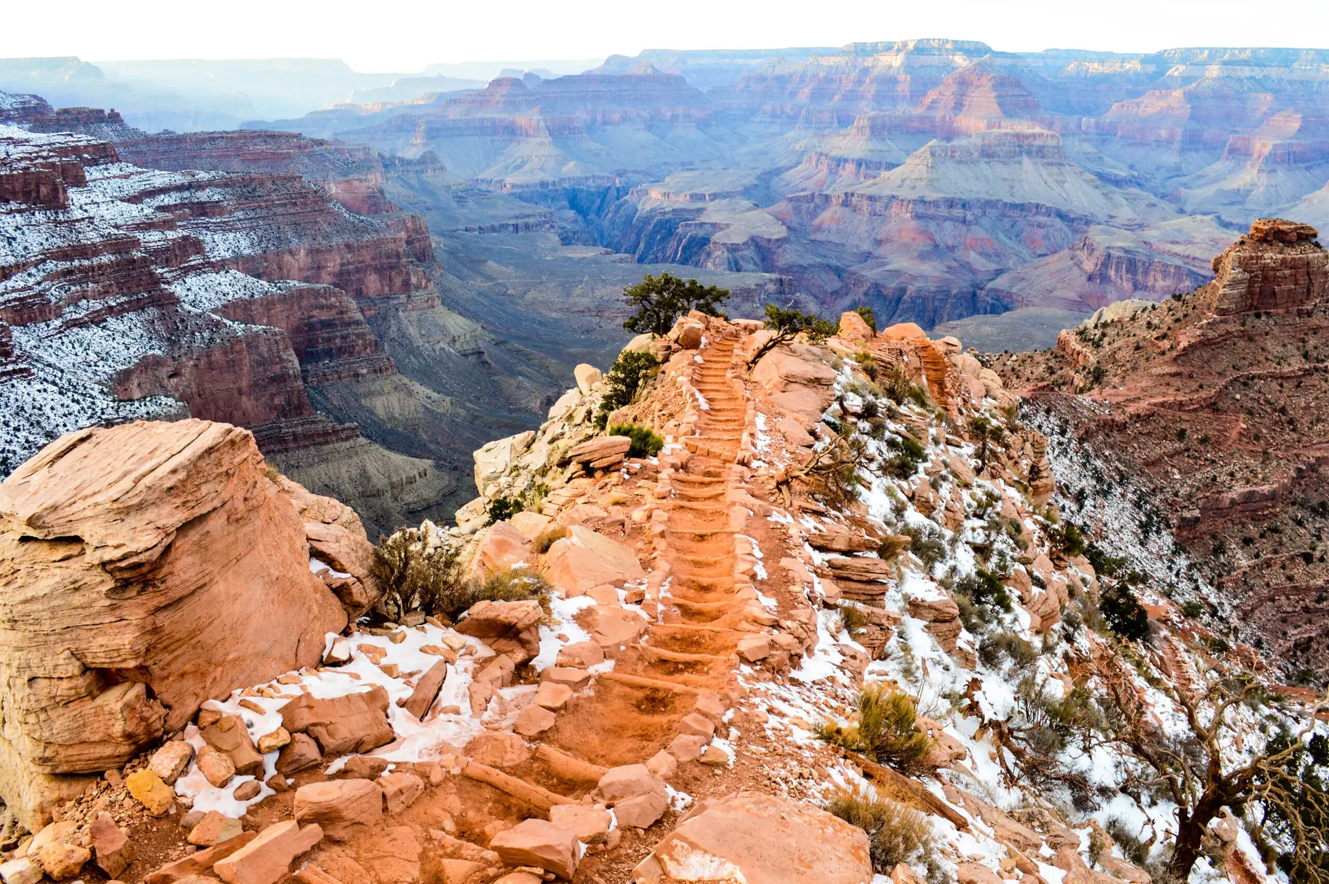
It is VERY IMPORTANT to PLAN your hike before you begin. No hike should be undertaken without understanding the unique challenges that hiking below the rim at the Grand Canyon present.
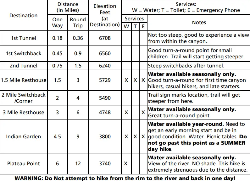
DISTANCE

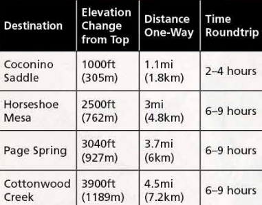
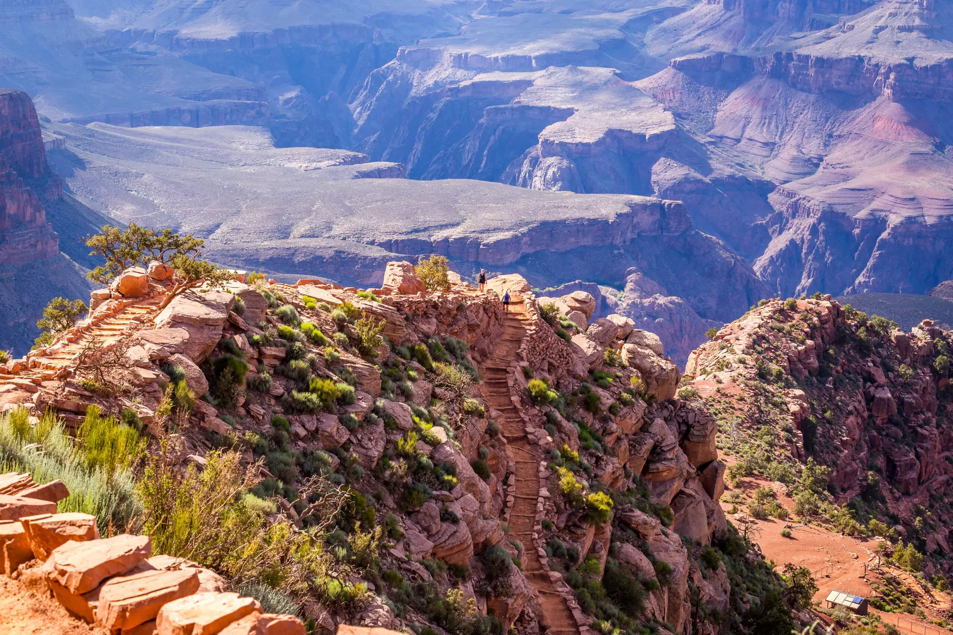
Many people overestimate how far they can hike, and this can be very dangerous at the Grand Canyon. Remember that it generally takes twice as long to hike OUT of the Canyon as it does to hike INTO the Canyon. ALL Below the Rim Trails at the Grand Canyon are steep and difficult.

WATER

Although water is available along SOME of the trails, you have to plan as if there is no water available, because at any time during your hike, there could be a break in the water lines. Always bring enough water for your entire hike.

WEATHER

The weather at the Grand Canyon changes minute by minute, and changes by elevation, so the weather you are experiencing at the beginning of your trail on the rim will be VASTLY different as you descend in elevation. This is especially important in the Summer, In general, temperature increases 5.5°F with each 1,000 feet loss in elevation.

STAY INFORMED

The National Park Service has a great deal of information about how to plan for your hike, and we encourage you to visit all of the links after this article. Visit this webpage now, for Hike Smart Tips from the NPS. Over 250 people are rescued from the canyon each year. The difference between a great adventure in Grand Canyon and a trip to the hospital (or worse) is up to YOU. DO NOT attempt to hike from the rim to the river and back in one day, especially during the months of May to September.
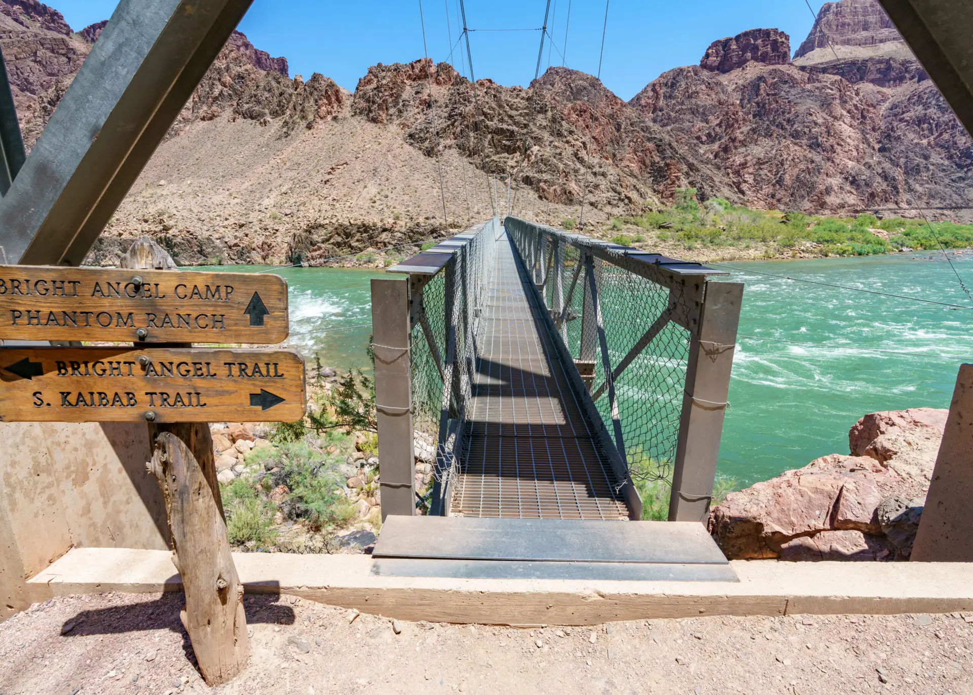
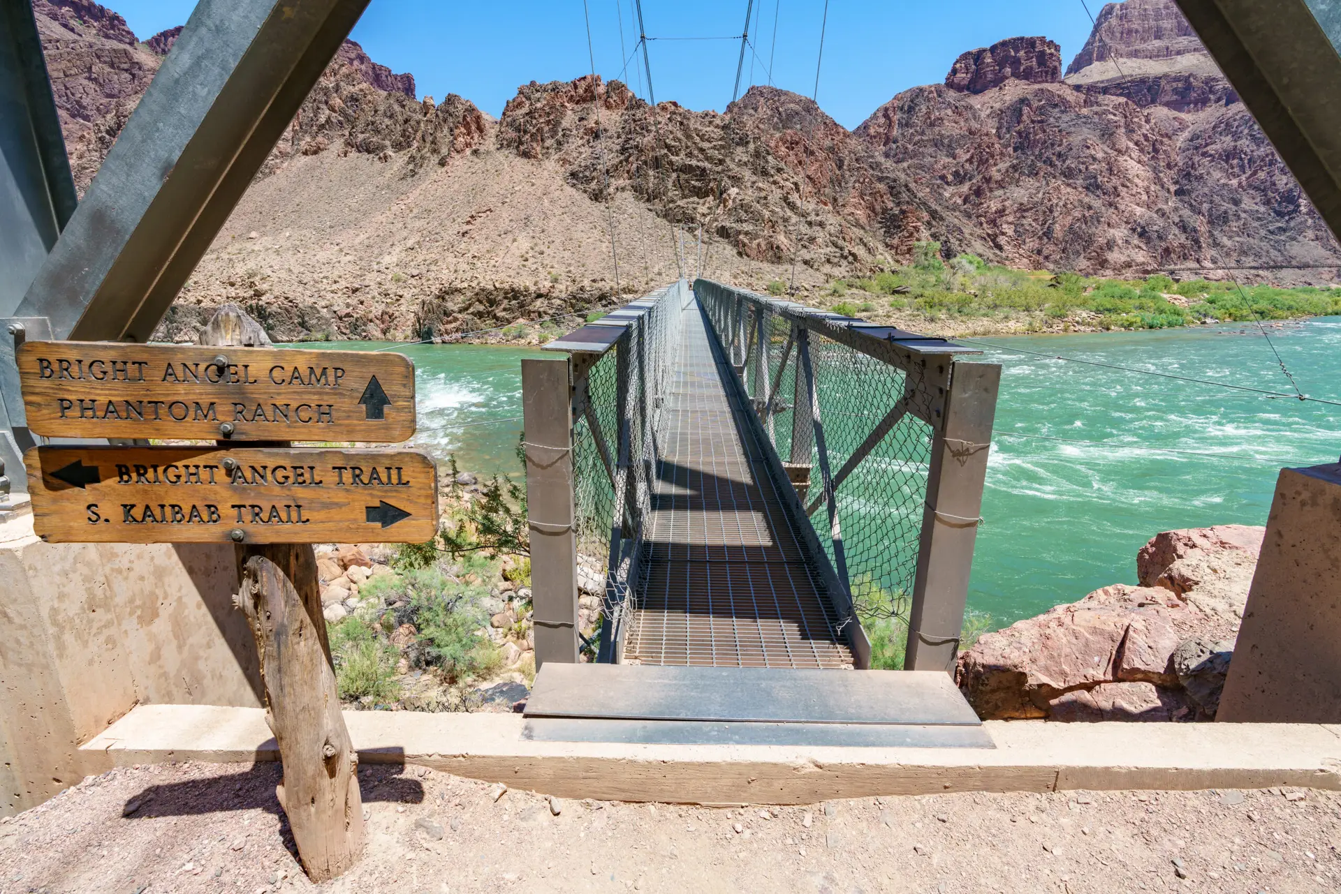
CAMPING

If you plan to camp overnight anywhere below the Rim on your hiking trip, you MUST get a permit from the Backcountry Permit’s Office.

Bright Angel Trail

The Bright Angel Trail, a true Grand Canyon classic, offers a challenging yet rewarding journey into the heart of this natural wonder. This maintained dirt trail descends steeply from the South Rim, with switchbacks that wind through the canyon’s colorful layers.

Key Features:

  • Well-defined trail: Easy to follow, even for beginners.
  • Partial shade: Canyon walls provide some respite from the sun.
  • Rest stops with facilities: Toilets and seasonal water (available from mid-May through mid-October) are available at rest stops along the trail.
  • Stunning scenery: Hike through tunnels, past impressive cliffs, and enjoy breathtaking views.


Important Considerations:

  • Steep incline: Be prepared for a challenging climb on your way back up.
  • Mule traffic: Step aside and give mules the right of way.
  • Ice in winter: The upper portion can be icy during winter and early spring.
  • Download trail maps: Cell service is unreliable; download maps in advance.
  • Check water availability: Confirm water sources are operational before your hike.

Planning Your Hike:

  • Distance: Varies depending on your turnaround point. Popular options include Mile-and-a-Half Resthouse (3 miles roundtrip) and Havasupai Gardens (9 miles roundtrip).
  • Time: Allow twice as long to hike up as it takes to hike down.
  • Essential Gear: Sturdy boots, plenty of water, and snacks.

Unique Insights: History, Geology, and Must-See Spots

  • History: The Bright Angel Trail boasts a captivating history. Initially a Native American route, it was later developed into a private toll road by businessman Ralph Cameron. After years of ownership disputes involving private citizens, the Santa Fe Railway, and government officials, control finally transferred to the National Park Service in 1928.
  • Rim-to-Rim Hike: For a truly epic adventure, consider a Rim-to-Rim hike using the Bright Angel Trail. By setting up a shuttle service, you can begin your journey on one rim and ascend to the other, experiencing the full grandeur of the canyon.
  • Geology: As you descend, you’ll traverse through layers of rock that unveil the Grand Canyon’s fascinating geological history.
  • Must-see spots: Don’t miss the historic rest houses, the Indian Garden oasis, and the awe-inspiring views from Plateau Point.

Trail Chart


Grandview Trail

For those seeking a more adventurous and less crowded path, the Grandview Trail beckons. This historic trail, once used by miners, offers a rugged and rewarding experience.

Key Features:

  • Historic significance: Follow in the footsteps of 19th-century prospectors.
  • Challenging terrain: Steep descents, uneven surfaces, and cobbled sections.
  • Spectacular views: Panoramic vistas of the canyon and the Colorado River.
  • Horseshoe Mesa: Explore the historic mining site and enjoy stunning views.

Important Considerations:

  • Limited shade: Plan your hike accordingly, especially during hotter months.
  • Difficult footing: Wear sturdy boots and watch your step.
  • Ice in winter: The upper portion can be icy during winter and early spring.
  • Download trail maps: Cell service is unreliable; download maps in advance.
  • No Water Available on Trail: There is no water along the trail, though there is a spring-fed water filling station at the trailhead during the summer.

Planning Your Hike:

  • Distance: 10.6-mile loop trail.
  • Difficulty: Highly challenging, suitable for experienced hikers.
  • Essential Gear: Hiking pants, plenty of water, and navigation tools.

Unique Insights: History, Geology, and Must-See Spots

  • History: The Grandview Trail holds a unique place in Grand Canyon history. It was constructed by Pete Berry, a prospector who sought to access his copper claims on Horseshoe Mesa in the late 1800s. Remnants of his mining operation can still be seen today, adding a tangible link to the canyon’s past.
  • Backpacking Adventures: For those seeking an extended adventure, the Grandview Trail offers exciting backpacking opportunities. With various routes and campgrounds available, you can immerse yourself in the canyon’s wilderness. Consider exploring Horseshoe Mesa, Hance Creek, or Cottonwood Creek for overnight stays.
  • Geology: Observe the dramatic Coconino Saddle, where the Coconino Sandstone meets the Hermit Shale, showcasing the canyon’s diverse geological formations.
  • Must-see spots: Explore the remnants of Berry’s mining operation on Horseshoe Mesa and enjoy the panoramic views from Coconino Saddle

Trail Chart